Data Science for Agriculture
How to manage and manipulate data for agricultural research

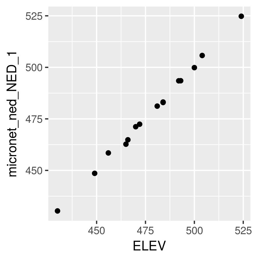
Your advisor wants to conduct an analysis using weather data from the USDA ARS Micronet installed within the experimental watershed near Fort Cobb, OK. She gives you a link to a shapefile that contains metadata for each of the stations. She wants you to check the elevation data in the shapefile against the National Elevation Dataset (NED) created and maintained by the USGS.
Install the FedData package and read in the shapefile for the Fort Cobb Micronet.
Use the Fort Cobb Micronet layer with the get_ned() function from the FedData package to download the NED data for your area of interest.
Use the extract() function from the raster package to extract the NED values for each point in the Fort Cobb Micronet layer. (Hint: Use the sp argument to return a SpatialPointsDataFrame.)
Use ggplot() to create a scatter plot with elevation from the Micronet layer on the y-axis and elevation from the NED on the x-axis. Set your axis labels appropriately.